By blackmountaincycles,
Filed under: Uncategorized
I was just treated to a June 1 burst of rain for the past couple hours. The rain pattern has been disturbingly random the past week. Then there’s also the matter of the wind when it’s not raining. It’s hard enough to get out on the bike in the rain (so I haven’t), but when it’s not raining, the wind, last week, has been in the 15-25mph range with gusts on my favorite road loops up into the 30’s. Luckily, there is a great cross loop that is out of the wind most of the ride and when you do pop out in to the wind you either get a tail wind on a climb or a head wind on a descent. Either way, not bad.

Here’s some photos of that cross loop taken between squalls.
The ceanothus has been going off.

The rain has kept the hillside grasses nice and green through May.
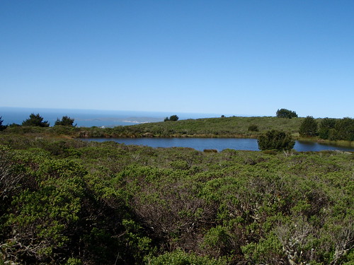
This pond on the top of Mt. Vision is like one of those pools fancy rich people have that overlook the coast with the vanishing edge. This view over Drake’s Bay is free to anyone willing to climb to the top.
From the top of Mt. Vision overlooking Black Mountain and the south end of Tomales Bay.
Looking south to Mt. Wittenberg and there’s the Inverness Ridge Trail which is a rip-roarin’ fun trail for the cross bike.
Not sure what this is at the top of Mt. Vision, but I think it’s some sort of aviation transmitter/receiver site.
(What’s playing: The Replacements Achin’ To Be)
« Prev
What’s behind you…
What’s behind you…
Next »
Rabbit – Hat …
Rabbit – Hat …


The radio tower on top of Mt Vision is for MERA (MARIN EMERGENCY RADIO AUTHORITY).
KWMR also has an antenna attached to the MERA tower there! Fun fact since you are involved with KMWR.
Src: http://www.meraonline.com/MeraRpts/506_AgendaItem_A_6_09_11_PropsdLicenseAgmt_MERA_KWMR.pdf
The KWMR transmitter and associated hardware is located in the building in the background of the shot overlooking the bay. The antennae is just to the left of that building.
The white objects arranged in a circular pattern in the last photo is called VORTAC – used as a navigation beacon for aviation.